

Key Insights
The Italian Satellite Imagery Services Market is poised for robust expansion, driven by a compelling CAGR of 10.89% from 2019 to 2033. While the specific market size for Italy is not explicitly stated, industry benchmarks and the strong growth trajectory suggest it represents a significant and expanding segment within the European market. This growth is fueled by escalating demand across various critical applications, including natural resource management, enhanced surveillance and security operations, crucial conservation and research initiatives, and vital disaster management efforts. The increasing adoption of satellite imagery by government entities for policy implementation and infrastructure planning, coupled with its growing utility in the construction and transportation sectors for project monitoring and logistics optimization, are key drivers. Furthermore, the military and defense sector's reliance on advanced geospatial intelligence for strategic operations is a significant contributor to market momentum. The forecast period, particularly from 2025 onwards, is expected to witness accelerated adoption as technological advancements in satellite resolution, data processing, and analytics become more accessible and sophisticated.
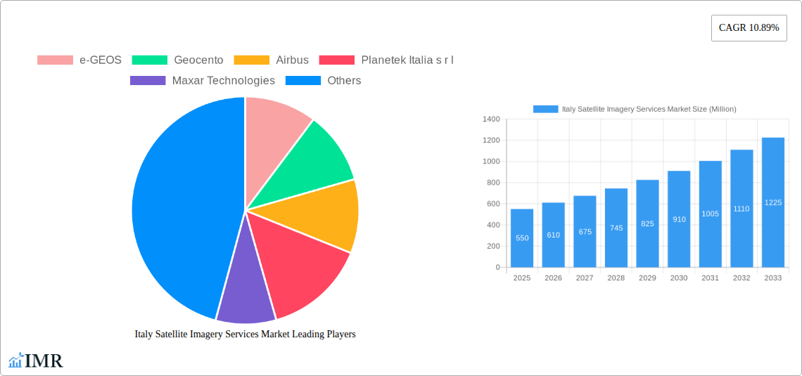
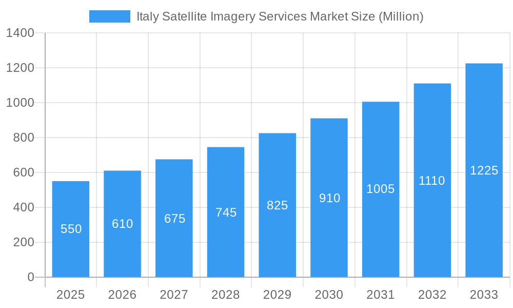
Italy Satellite Imagery Services Market Market Size (In Million)
The Italian market is characterized by a dynamic landscape of key players, including established global entities like Airbus and Maxar Technologies, alongside specialized European firms such as e-GEOS, Geocento, and Thales Alenia Space. This competitive environment fosters innovation and drives the development of advanced solutions catering to diverse end-user needs. Emerging trends such as the integration of AI and machine learning for automated image analysis, the rise of cloud-based geospatial platforms, and the increasing use of very high-resolution (VHR) imagery are shaping the market. However, certain restraints, such as the high initial investment for sophisticated satellite systems and the need for skilled personnel to interpret complex geospatial data, may present challenges. Nevertheless, the overarching trend points towards a market that will continue to grow, demonstrating the indispensable role of satellite imagery services in supporting Italy's economic, environmental, and security objectives. The continuous evolution of technology and expanding applications in sectors like forestry and agriculture further solidify the positive outlook for this market.
Italy Satellite Imagery Services Market Company Market Share
This comprehensive report provides an in-depth analysis of the Italy Satellite Imagery Services Market, offering critical insights into market dynamics, growth trends, segmentation, competitive landscape, and future opportunities. Leveraging advanced analytics and extensive primary and secondary research, this study is an essential resource for stakeholders seeking to understand and capitalize on the burgeoning Italian geospatial industry. The report covers the Study Period: 2019–2033, with a Base Year: 2025, Estimated Year: 2025, and Forecast Period: 2025–2033, building upon Historical Period: 2019–2024. We present all monetary values in Million Units.
Italy Satellite Imagery Services Market Market Dynamics & Structure
The Italy Satellite Imagery Services Market exhibits a moderately concentrated structure, with a mix of established global players and specialized Italian providers vying for market share. Technological innovation is a paramount driver, fueled by advancements in satellite sensors, data processing algorithms, and cloud-based platforms, enabling higher resolution and more frequent Earth observation. Regulatory frameworks, particularly those from the European Union and Italian national agencies, are increasingly shaping data accessibility, privacy, and security protocols, influencing market entry and operational strategies. Competitive product substitutes, such as aerial imagery and ground-based sensors, pose a moderate threat but are often complemented by satellite data for broader coverage and scale. End-user demographics are diverse, with significant demand originating from government entities for defense and civilian applications, and growing adoption in commercial sectors like infrastructure, agriculture, and energy. Mergers and acquisitions (M&A) trends, while not yet at peak levels, are anticipated to accelerate as larger entities seek to consolidate capabilities and expand their service portfolios. For instance, the ongoing development of Italy's IRIDE constellation signifies a strategic move towards sovereign Earth observation capabilities.
- Market Concentration: Moderate, with key global players and strong domestic presence.
- Technological Innovation Drivers: High-resolution sensors, AI-powered analytics, cloud integration.
- Regulatory Frameworks: EU and Italian national space policies, data protection, security standards.
- Competitive Product Substitutes: Aerial photography, drone-based imaging, ground surveys.
- End-User Demographics: Government (defense, civil protection), Commercial (agriculture, construction, energy, logistics).
- M&A Trends: Nascent but expected to increase with industry consolidation.
Italy Satellite Imagery Services Market Growth Trends & Insights
The Italy Satellite Imagery Services Market is projected for substantial growth over the forecast period, driven by increasing demand for actionable geospatial intelligence across various sectors. Market size evolution is intrinsically linked to government investments in space programs, the expansion of commercial Earth observation capabilities, and the growing awareness of satellite imagery's utility in addressing complex challenges. Adoption rates for satellite imagery services are steadily rising, particularly within the government and defense sectors, as well as in emerging applications like precision agriculture and environmental monitoring. Technological disruptions, including the proliferation of small satellites, advancements in Synthetic Aperture Radar (SAR) technology, and the integration of artificial intelligence for data interpretation, are reshaping the market by offering more cost-effective and sophisticated solutions. Consumer behavior shifts are characterized by a move from raw data consumption to demand for value-added services and end-to-end solutions. The CAGR for the Italy Satellite Imagery Services Market is estimated at approximately 12.5% between 2025 and 2033, reflecting this robust growth trajectory. Market penetration is currently around 20% for core government applications and is rapidly expanding into commercial sectors.
Dominant Regions, Countries, or Segments in Italy Satellite Imagery Services Market
The Government end-user segment is poised to be the dominant force driving growth within the Italy Satellite Imagery Services Market. This dominance stems from significant and sustained investment in national security, civil protection, environmental monitoring, and infrastructure development initiatives. The Italian government's commitment to enhancing its sovereign Earth observation capabilities, exemplified by the IRIDE constellation, underscores this trend.
- Government: This segment is characterized by high demand for Geospatial Data Acquisition and Mapping, Surveillance and Security, and Disaster Management applications. The need for real-time situational awareness, border monitoring, and rapid response to natural calamities directly translates into substantial uptake of satellite imagery services. The Military and Defense sub-segment within government is a critical driver, requiring advanced surveillance and reconnaissance capabilities.
- Infrastructure Development: The Construction and Transportation and Logistics sectors are increasingly leveraging satellite imagery for project planning, site selection, progress monitoring, and supply chain optimization. This translates into substantial demand for optical and radar data.
- Environmental Focus: The Conservation and Research and Forestry and Agriculture segments are experiencing significant growth due to increased awareness of climate change, biodiversity loss, and the need for sustainable resource management. Satellite imagery provides invaluable data for crop health assessment, deforestation monitoring, land use mapping, and water resource management.
- Technological Advancements: The Italian government's strategic investments in new satellite constellations, like IRIDE, will directly boost demand for Geospatial Data Acquisition and Mapping services, providing more frequent and higher-resolution data.
- Economic Policies: Favorable national and European Union policies promoting the use of space technologies for economic growth and societal benefit further accelerate market penetration across all segments.
- Market Share & Growth Potential: The government segment is estimated to hold over 40% of the market share in 2025 and is projected to maintain a strong growth rate of approximately 13% CAGR through 2033, owing to its intrinsic reliance on sophisticated Earth observation for national interests and public services.
Italy Satellite Imagery Services Market Product Landscape
The product landscape of the Italy Satellite Imagery Services Market is characterized by a continuous stream of innovations aimed at enhancing data quality, accessibility, and analytical capabilities. High-resolution optical imagery, offering unprecedented detail for urban planning and infrastructure monitoring, is a key offering. Advancements in Synthetic Aperture Radar (SAR) technology provide all-weather, day-and-night imaging capabilities, crucial for disaster management and resource exploration. Furthermore, the integration of Artificial Intelligence (AI) and Machine Learning (ML) algorithms is transforming raw imagery into actionable intelligence, enabling automated feature extraction, change detection, and predictive analytics. The growing availability of multispectral and hyperspectral data is unlocking new applications in precision agriculture and environmental science. The IRIDE constellation represents a significant leap forward, promising a diverse array of imaging payloads to cater to multifaceted user needs.
Key Drivers, Barriers & Challenges in Italy Satellite Imagery Services Market
Key Drivers:
- Government Investments: Substantial funding for national security, civil protection, and space programs, including the IRIDE constellation.
- Technological Advancements: Innovation in sensor technology, data processing, and AI/ML for enhanced accuracy and efficiency.
- Growing Demand for Geospatial Intelligence: Increasing recognition of satellite imagery's utility in sectors like agriculture, infrastructure, and environmental monitoring.
- EU Space Policy Support: Favorable regulatory and funding initiatives from the European Union promoting Earth observation.
- Climate Change Mitigation: The urgent need for data-driven solutions for environmental monitoring and disaster response.
Barriers & Challenges:
- High Initial Investment Costs: The significant capital expenditure required for satellite development and ground infrastructure.
- Data Processing Complexity: The need for skilled personnel and advanced infrastructure to process and analyze vast amounts of satellite data.
- Regulatory Hurdles: Navigating complex data sharing agreements, privacy concerns, and international regulations.
- Market Competition: Intense competition from established global players and emerging niche providers.
- Supply Chain Dependencies: Reliance on international launch providers and component manufacturers can pose risks.
- Cybersecurity Threats: Protecting sensitive geospatial data from cyberattacks is a growing concern.
Emerging Opportunities in Italy Satellite Imagery Services Market
Emerging opportunities in the Italy Satellite Imagery Services Market lie in the burgeoning demand for integrated geospatial solutions that combine optical, radar, and other sensor data for advanced analytics. The expansion of AI-powered platforms for automated object detection, predictive modeling, and real-time monitoring presents significant avenues for growth. Untapped markets include the granular application of satellite data in smart city initiatives, precision urban farming, and enhanced supply chain visibility. Furthermore, the growing focus on ESG (Environmental, Social, and Governance) reporting creates a demand for verifiable satellite data for sustainability assessments and carbon footprint monitoring. The ongoing development of constellations like IRIDE will foster an ecosystem for specialized service providers offering tailored solutions for niche applications.
Growth Accelerators in the Italy Satellite Imagery Services Market Industry
The long-term growth of the Italy Satellite Imagery Services Market is being significantly accelerated by a confluence of technological breakthroughs and strategic initiatives. The maturation of AI and machine learning algorithms is enabling the extraction of deeper insights from satellite data, driving efficiency and opening new analytical frontiers. Strategic partnerships between satellite operators, data analytics firms, and end-users are fostering collaborative innovation and the development of bespoke solutions. Market expansion strategies are being fueled by the increasing adoption of cloud-based platforms, which democratize access to satellite data and analytical tools, thereby lowering barriers to entry for smaller businesses and research institutions. The continuous evolution of sensor technology, leading to higher spatial, spectral, and temporal resolutions, is a perpetual growth catalyst, expanding the applicability of satellite imagery across an ever-wider range of sectors.
Key Players Shaping the Italy Satellite Imagery Services Market Market
- e-GEOS
- Geocento
- Airbus
- Planetek Italia s r l
- Maxar Technologies
- L3Harris Technologies
- Viasat Group S p A
- EUSI
- Thales Alenia Space
- OHB-Italia S p A
Notable Milestones in Italy Satellite Imagery Services Market Sector
- March 2023: Arianespace announced signing a contract with the European Space Agency (ESA), acting on behalf of the Italian government, for launching the IRIDE constellation of imaging satellites. The agreement includes two firm Vega C launches, starting in late 2025, with an option for a third. The Italian government funds the IRIDE constellation. It will consist of 36 satellites built by a consortium of Italian companies equipped with various imaging payloads, including optical and radar.
- October 2022: Europe's Copernicus Earth-observing mission Sentinel-2 satellite captured a striking satellite image of Italy's Stromboli volcano less than 5 hours after it erupted early on Oct. 9. The satellite image, processed in proper colors, shows lava pouring into the sea and vast plumes of ash and smoke rising above the volcano. The satellite images prompted the civil protection authorities in Italy to raise an orange alert due to enhanced volcano imbalance.
In-Depth Italy Satellite Imagery Services Market Market Outlook
The Italy Satellite Imagery Services Market is on a trajectory of robust expansion, driven by a strategic confluence of governmental support, technological innovation, and increasing commercial adoption. The substantial investments in national Earth observation infrastructure, such as the IRIDE constellation, are set to unlock unprecedented data acquisition capabilities, fostering a fertile ground for advanced geospatial analytics and value-added services. Growth accelerators include the pervasive integration of AI and machine learning for automated data interpretation and predictive insights, alongside the development of cloud-based platforms that enhance accessibility and collaboration. Emerging opportunities in precision agriculture, smart city development, and comprehensive environmental monitoring will further fuel market penetration. The market outlook is overwhelmingly positive, signaling significant potential for stakeholders who can effectively leverage cutting-edge technology and cater to the evolving demands for actionable geospatial intelligence.
Italy Satellite Imagery Services Market Segmentation
-
1. Application
- 1.1. Geospatial Data Acquisition and Mapping
- 1.2. Natural Resource Management
- 1.3. Surveillance and Security
- 1.4. Conservation and Research
- 1.5. Disaster Management
- 1.6. Intelligence
-
2. End-User
- 2.1. Government
- 2.2. Construction
- 2.3. Transportation and Logistics
- 2.4. Military and Defense
- 2.5. Forestry and Agriculture
- 2.6. Others
Italy Satellite Imagery Services Market Segmentation By Geography
- 1. Italy
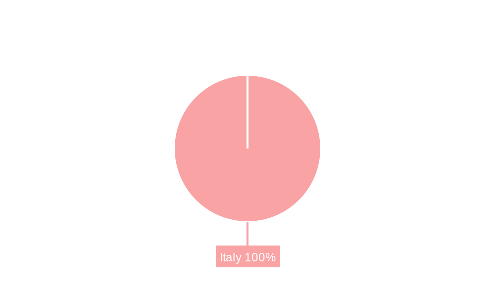
Italy Satellite Imagery Services Market Regional Market Share
Geographic Coverage of Italy Satellite Imagery Services Market
Italy Satellite Imagery Services Market REPORT HIGHLIGHTS
| Aspects | Details |
|---|---|
| Study Period | 2020-2034 |
| Base Year | 2025 |
| Estimated Year | 2026 |
| Forecast Period | 2026-2034 |
| Historical Period | 2020-2025 |
| Growth Rate | CAGR of 10% from 2020-2034 |
| Segmentation |
|
Table of Contents
- 1. Introduction
- 1.1. Research Scope
- 1.2. Market Segmentation
- 1.3. Research Objective
- 1.4. Definitions and Assumptions
- 2. Executive Summary
- 2.1. Market Snapshot
- 3. Market Dynamics
- 3.1. Market Drivers
- 3.2. Market Restrains
- 3.3. Market Trends
- 3.4. Market Opportunities
- 4. Market Factor Analysis
- 4.1. Porters Five Forces
- 4.1.1. Bargaining Power of Suppliers
- 4.1.2. Bargaining Power of Buyers
- 4.1.3. Threat of New Entrants
- 4.1.4. Threat of Substitutes
- 4.1.5. Competitive Rivalry
- 4.2. PESTEL analysis
- 4.3. BCG Analysis
- 4.3.1. Stars (High Growth, High Market Share)
- 4.3.2. Cash Cows (Low Growth, High Market Share)
- 4.3.3. Question Mark (High Growth, Low Market Share)
- 4.3.4. Dogs (Low Growth, Low Market Share)
- 4.4. Ansoff Matrix Analysis
- 4.5. Supply Chain Analysis
- 4.6. Regulatory Landscape
- 4.7. Current Market Potential and Opportunity Assessment (TAM–SAM–SOM Framework)
- 4.8. IMR Analyst Note
- 4.1. Porters Five Forces
- 5. Market Analysis, Insights and Forecast 2021-2033
- 5.1. Market Analysis, Insights and Forecast - by Application
- 5.1.1. Geospatial Data Acquisition and Mapping
- 5.1.2. Natural Resource Management
- 5.1.3. Surveillance and Security
- 5.1.4. Conservation and Research
- 5.1.5. Disaster Management
- 5.1.6. Intelligence
- 5.2. Market Analysis, Insights and Forecast - by End-User
- 5.2.1. Government
- 5.2.2. Construction
- 5.2.3. Transportation and Logistics
- 5.2.4. Military and Defense
- 5.2.5. Forestry and Agriculture
- 5.2.6. Others
- 5.3. Market Analysis, Insights and Forecast - by Region
- 5.3.1. Italy
- 5.1. Market Analysis, Insights and Forecast - by Application
- 6. Italy Satellite Imagery Services Market Analysis, Insights and Forecast, 2021-2033
- 6.1. Market Analysis, Insights and Forecast - by Application
- 6.1.1. Geospatial Data Acquisition and Mapping
- 6.1.2. Natural Resource Management
- 6.1.3. Surveillance and Security
- 6.1.4. Conservation and Research
- 6.1.5. Disaster Management
- 6.1.6. Intelligence
- 6.2. Market Analysis, Insights and Forecast - by End-User
- 6.2.1. Government
- 6.2.2. Construction
- 6.2.3. Transportation and Logistics
- 6.2.4. Military and Defense
- 6.2.5. Forestry and Agriculture
- 6.2.6. Others
- 6.1. Market Analysis, Insights and Forecast - by Application
- 7. Competitive Analysis
- 7.1. Company Profiles
- 7.1.1 e-GEOS
- 7.1.1.1. Company Overview
- 7.1.1.2. Products
- 7.1.1.3. Company Financials
- 7.1.1.4. SWOT Analysis
- 7.1.2 Geocento
- 7.1.2.1. Company Overview
- 7.1.2.2. Products
- 7.1.2.3. Company Financials
- 7.1.2.4. SWOT Analysis
- 7.1.3 Airbus
- 7.1.3.1. Company Overview
- 7.1.3.2. Products
- 7.1.3.3. Company Financials
- 7.1.3.4. SWOT Analysis
- 7.1.4 Planetek Italia s r l
- 7.1.4.1. Company Overview
- 7.1.4.2. Products
- 7.1.4.3. Company Financials
- 7.1.4.4. SWOT Analysis
- 7.1.5 Maxar Technologies
- 7.1.5.1. Company Overview
- 7.1.5.2. Products
- 7.1.5.3. Company Financials
- 7.1.5.4. SWOT Analysis
- 7.1.6 L3Harris Technologies*List Not Exhaustive
- 7.1.6.1. Company Overview
- 7.1.6.2. Products
- 7.1.6.3. Company Financials
- 7.1.6.4. SWOT Analysis
- 7.1.7 Viasat Group S p A
- 7.1.7.1. Company Overview
- 7.1.7.2. Products
- 7.1.7.3. Company Financials
- 7.1.7.4. SWOT Analysis
- 7.1.8 EUSI
- 7.1.8.1. Company Overview
- 7.1.8.2. Products
- 7.1.8.3. Company Financials
- 7.1.8.4. SWOT Analysis
- 7.1.9 Thales Alenia Space
- 7.1.9.1. Company Overview
- 7.1.9.2. Products
- 7.1.9.3. Company Financials
- 7.1.9.4. SWOT Analysis
- 7.1.10 OHB-Italia S p A
- 7.1.10.1. Company Overview
- 7.1.10.2. Products
- 7.1.10.3. Company Financials
- 7.1.10.4. SWOT Analysis
- 7.1.1 e-GEOS
- 7.2. Market Entropy
- 7.2.1 Company's Key Areas Served
- 7.2.2 Recent Developments
- 7.3. Company Market Share Analysis 2025
- 7.3.1 Top 5 Companies Market Share Analysis
- 7.3.2 Top 3 Companies Market Share Analysis
- 7.4. List of Potential Customers
- 8. Research Methodology
List of Figures
- Figure 1: Italy Satellite Imagery Services Market Revenue Breakdown (billion, %) by Product 2025 & 2033
- Figure 2: Italy Satellite Imagery Services Market Share (%) by Company 2025
List of Tables
- Table 1: Italy Satellite Imagery Services Market Revenue billion Forecast, by Application 2020 & 2033
- Table 2: Italy Satellite Imagery Services Market Revenue billion Forecast, by End-User 2020 & 2033
- Table 3: Italy Satellite Imagery Services Market Revenue billion Forecast, by Region 2020 & 2033
- Table 4: Italy Satellite Imagery Services Market Revenue billion Forecast, by Application 2020 & 2033
- Table 5: Italy Satellite Imagery Services Market Revenue billion Forecast, by End-User 2020 & 2033
- Table 6: Italy Satellite Imagery Services Market Revenue billion Forecast, by Country 2020 & 2033
Frequently Asked Questions
1. What is the projected Compound Annual Growth Rate (CAGR) of the Italy Satellite Imagery Services Market?
The projected CAGR is approximately 10%.
2. Which companies are prominent players in the Italy Satellite Imagery Services Market?
Key companies in the market include e-GEOS, Geocento, Airbus, Planetek Italia s r l, Maxar Technologies, L3Harris Technologies*List Not Exhaustive, Viasat Group S p A, EUSI, Thales Alenia Space, OHB-Italia S p A.
3. What are the main segments of the Italy Satellite Imagery Services Market?
The market segments include Application, End-User.
4. Can you provide details about the market size?
The market size is estimated to be USD 2.83 billion as of 2022.
5. What are some drivers contributing to market growth?
Increasing Investments to Strengthen Country's Space Economy; Adoption of Big Data and Imagery Analytics.
6. What are the notable trends driving market growth?
Disaster Management Segment is Expected to Hold Significant Market Share.
7. Are there any restraints impacting market growth?
High Cost of Satellite Imaging Data Acquisition and Processing.
8. Can you provide examples of recent developments in the market?
March 2023: Arianespace announced signing a contract with the European Space Agency (ESA), acting on behalf of the Italian government, for launching the IRIDE constellation of imaging satellites. The agreement includes two firm Vega C launches, starting in late 2025, with an option for a third. The Italian government funds the IRIDE constellation. It will consist of 36 satellites built by a consortium of Italian companies equipped with various imaging payloads, including optical and radar.
9. What pricing options are available for accessing the report?
Pricing options include single-user, multi-user, and enterprise licenses priced at USD 3800, USD 4500, and USD 5800 respectively.
10. Is the market size provided in terms of value or volume?
The market size is provided in terms of value, measured in billion.
11. Are there any specific market keywords associated with the report?
Yes, the market keyword associated with the report is "Italy Satellite Imagery Services Market," which aids in identifying and referencing the specific market segment covered.
12. How do I determine which pricing option suits my needs best?
The pricing options vary based on user requirements and access needs. Individual users may opt for single-user licenses, while businesses requiring broader access may choose multi-user or enterprise licenses for cost-effective access to the report.
13. Are there any additional resources or data provided in the Italy Satellite Imagery Services Market report?
While the report offers comprehensive insights, it's advisable to review the specific contents or supplementary materials provided to ascertain if additional resources or data are available.
14. How can I stay updated on further developments or reports in the Italy Satellite Imagery Services Market?
To stay informed about further developments, trends, and reports in the Italy Satellite Imagery Services Market, consider subscribing to industry newsletters, following relevant companies and organizations, or regularly checking reputable industry news sources and publications.
Methodology
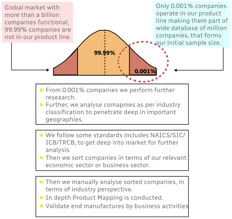
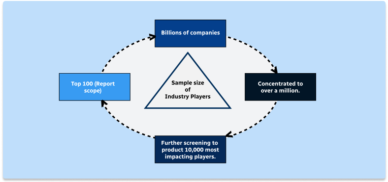
Step 1 - Identification of Relevant Samples Size from Population Database
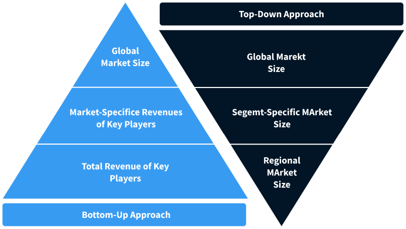
Step 2 - Approaches for Defining Global Market Size (Value, Volume* & Price*)
Note*: In applicable scenarios
Step 3 - Data Sources
Primary Research
- Web Analytics
- Survey Reports
- Research Institute
- Latest Research Reports
- Opinion Leaders
Secondary Research
- Annual Reports
- White Paper
- Latest Press Release
- Industry Association
- Paid Database
- Investor Presentations
Step 4 - Data Triangulation
Involves using different sources of information in order to increase the validity of a study
These sources are likely to be stakeholders in a program - participants, other researchers, program staff, other community members, and so on.
Then we put all data in single framework & apply various statistical tools to find out the dynamic on the market.
During the analysis stage, feedback from the stakeholder groups would be compared to determine areas of agreement as well as areas of divergence