

Key Insights
The North America Remote Sensing Satellites Market is poised for significant expansion, projected to reach an estimated $25.37 billion in 2025. This robust growth is driven by an anticipated Compound Annual Growth Rate (CAGR) of 11.59% through 2033, indicating a dynamic and evolving landscape. A primary catalyst for this surge is the increasing demand for high-resolution Earth observation data, fueled by advancements in satellite technology and the proliferation of applications across various sectors. Commercial entities are leveraging remote sensing for precision agriculture, environmental monitoring, and infrastructure management, while military and government agencies are increasingly reliant on these capabilities for defense, disaster response, and intelligence gathering. The market segments for satellites ranging from 10-100kg and 100-500kg are expected to witness considerable activity, reflecting a trend towards more versatile and deployable satellite constellations. Furthermore, the continued innovation in satellite subsystems, particularly in propulsion hardware, solar arrays, and advanced sensor technologies, will further propel market growth. The North American region, encompassing the United States, Canada, and Mexico, stands as a dominant force in this market due to substantial investments in space technologies and a strong ecosystem of established players and emerging innovators.
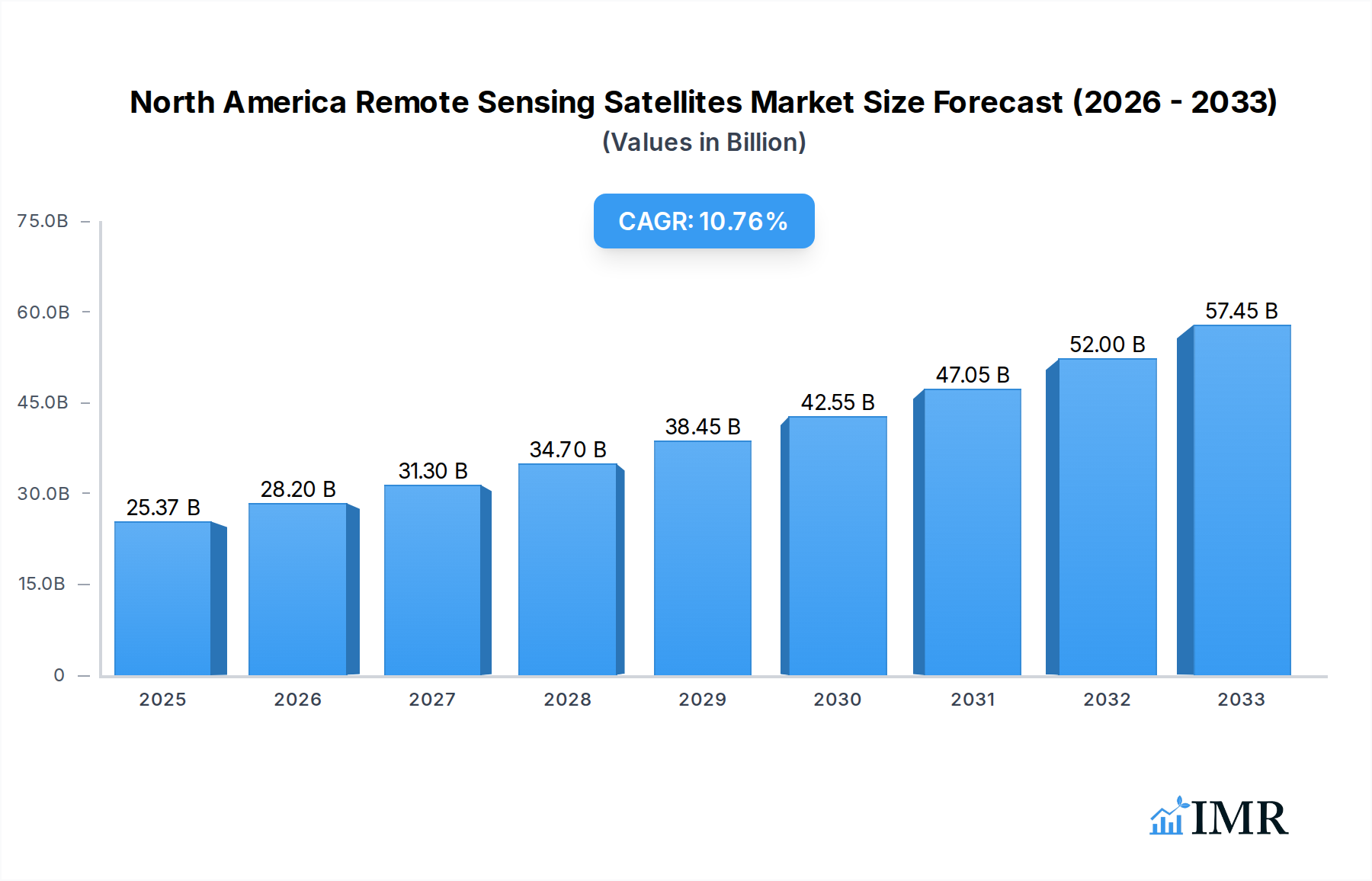
North America Remote Sensing Satellites Market Market Size (In Billion)
The market's upward trajectory is further supported by the growing adoption of LEO (Low Earth Orbit) constellations, enabling more frequent and detailed data acquisition. This shift towards LEO is addressing the need for near real-time monitoring and analysis, which is critical for timely decision-making in sectors such as climate change mitigation, urban planning, and resource management. While the market exhibits strong growth drivers, potential restraints such as the high cost of satellite development and launch, alongside increasing regulatory complexities, warrant strategic attention from market participants. However, the continuous technological advancements in miniaturization, artificial intelligence for data analysis, and improved launch capabilities are expected to mitigate these challenges, ensuring sustained expansion. Key players like Lockheed Martin Corporation, Maxar Technologies Inc., and Planet Labs Inc. are actively investing in research and development, expanding their satellite fleets, and forging strategic partnerships to capture market share. The emphasis on developing sophisticated satellite bus and subsystems, alongside robust propulsion hardware and propellants, will be crucial for meeting the escalating demands for sophisticated remote sensing solutions across North America.

North America Remote Sensing Satellites Market Company Market Share
Here's a compelling, SEO-optimized report description for the North America Remote Sensing Satellites Market:
North America Remote Sensing Satellites Market: Revolutionizing Earth Observation and Data Insights (2019–2033)
Unlock the future of North American Earth observation with this comprehensive analysis of the Remote Sensing Satellites Market. This in-depth report provides critical insights into market dynamics, growth trajectories, and key players shaping the landscape from 2019 to 2033, with a base year of 2025. Discover the escalating demand for advanced satellite imagery and data solutions across commercial, military, and government sectors, driven by advancements in satellite technology and increasing applications in environmental monitoring, urban planning, disaster management, and defense.
The North America Remote Sensing Satellites Market is projected to reach an estimated market size of $XX billion by 2025, and expand to $XX billion by 2033, exhibiting a robust Compound Annual Growth Rate (CAGR) of XX% during the forecast period. This report delves into the intricacies of the market, segmenting it by Satellite Mass (Below 10 Kg, 10-100kg, 100-500kg, 500-1000kg, above 1000kg), Orbit Class (LEO, MEO, GEO), Satellite Subsystem (Propulsion Hardware and Propellant, Satellite Bus & Subsystems, Solar Array & Power Hardware, Structures, Harness & Mechanisms), and End User (Commercial, Military & Government, Other). It meticulously analyzes the influence of leading companies and industry developments, offering a definitive guide for stakeholders navigating this dynamic sector.
North America Remote Sensing Satellites Market Market Dynamics & Structure
The North America Remote Sensing Satellites Market is characterized by a dynamic interplay of technological innovation, evolving regulatory frameworks, and increasing end-user demand. Market concentration is moderately fragmented, with key players continually investing in research and development to enhance satellite capabilities and data processing. Technological innovation drivers include the miniaturization of satellite components, advancements in sensor technology leading to higher resolution imagery, and the development of sophisticated artificial intelligence (AI) and machine learning algorithms for data analysis. Regulatory frameworks, while largely supportive of commercial space ventures, still present considerations for spectrum allocation and data privacy. Competitive product substitutes are emerging from advanced aerial imagery and ground-based sensor networks, although satellites maintain a distinct advantage in terms of coverage, frequency, and persistent monitoring. End-user demographics are expanding, with growing adoption in commercial sectors like agriculture, insurance, and logistics, alongside sustained demand from military and government agencies for national security and environmental monitoring. Mergers and acquisitions (M&A) are a notable trend, as companies seek to consolidate capabilities, expand market reach, and acquire specialized technologies. For instance, strategic acquisitions can bolster a company's offering in specific satellite subsystems or end-user segments.
- Market Concentration: Moderately fragmented with leading players and emerging innovators.
- Technological Innovation: Driven by miniaturization, higher resolution sensors, and AI-powered data analytics.
- Regulatory Landscape: Supportive for commercialization but with specific considerations.
- Competitive Landscape: Satellites face competition from aerial and ground-based solutions.
- End-User Growth: Significant expansion in commercial applications alongside government reliance.
- M&A Activity: Key strategy for market consolidation and capability enhancement.
North America Remote Sensing Satellites Market Growth Trends & Insights
The North America Remote Sensing Satellites Market is on a significant upward trajectory, fueled by a confluence of market size evolution, accelerating adoption rates, and transformative technological disruptions. The market's growth is not merely incremental but represents a paradigm shift in how we observe and understand our planet. The market size has seen a substantial expansion from $XX billion in 2019 to an estimated $XX billion in 2025, with projections indicating continued robust growth to $XX billion by 2033. This expansion is driven by a burgeoning demand for real-time, high-resolution Earth observation data across an increasingly diverse range of applications.
Adoption rates are accelerating across both established and emerging sectors. The commercial sector, in particular, is witnessing a surge in the utilization of remote sensing data for applications such as precision agriculture, infrastructure monitoring, environmental impact assessments, and supply chain optimization. This increased adoption is a direct consequence of the enhanced affordability and accessibility of satellite data, thanks to the proliferation of small satellites (smallsats) and constellations.
Technological disruptions are at the forefront of this growth. The development of advanced Synthetic Aperture Radar (SAR) and hyperspectral imaging capabilities allows for unprecedented levels of detail and insight, enabling observation through clouds, at night, and across a wider electromagnetic spectrum. The integration of AI and machine learning with satellite data processing is revolutionizing data interpretation, enabling faster and more accurate insights. For example, AI algorithms can now automatically detect subtle changes in land use, monitor crop health with high precision, or identify infrastructure vulnerabilities.
Consumer behavior shifts are also playing a crucial role. Businesses and governments are increasingly recognizing the strategic value of Earth observation data for informed decision-making, risk mitigation, and resource management. This has led to a greater willingness to invest in satellite-based solutions and data services. Furthermore, the growing global awareness of environmental challenges, such as climate change and natural resource depletion, is creating a strong impetus for continuous Earth monitoring, a domain where remote sensing satellites excel. The increasing availability of data through initiatives and agreements, like those between NASA and commercial providers, further democratizes access and fosters innovation, propelling market penetration to new heights. The projected CAGR of XX% underscores the market's dynamic and expanding nature.
Dominant Regions, Countries, or Segments in North America Remote Sensing Satellites Market
The North America Remote Sensing Satellites Market is experiencing robust growth driven by specific segments and the dominant presence of the United States. Within the Satellite Mass segmentation, the 10-100kg and 100-500kg categories are particularly dominant. These size classes represent the sweet spot for the deployment of constellations of small satellites and medium-sized satellites, which offer a compelling balance of capability, cost-effectiveness, and launch flexibility. The rise of constellations has significantly increased the volume of data collected and the revisit rates for specific locations, meeting the growing demand for near real-time monitoring. The above 1000kg segment continues to be crucial for high-resolution imaging and specialized missions requiring significant payload capacity, often driven by military and advanced scientific applications.
In terms of Orbit Class, LEO (Low Earth Orbit) is the most dominant and fastest-growing segment. The proliferation of LEO satellite constellations has revolutionized Earth observation by enabling frequent revisits of the Earth's surface, facilitating applications that require up-to-the-minute data. MEO (Medium Earth Orbit) and GEO (Geostationary Orbit) satellites continue to play vital roles for specific applications, such as continuous weather monitoring (GEO) or navigation systems (MEO), but LEO's agility and data acquisition frequency are driving overall market expansion.
The Satellite Subsystem driving significant market activity and demand is Satellite Bus & Subsystems. This encompasses the core structural, power, and communication components essential for satellite operation. As the number of satellites launched increases, so does the demand for these foundational elements. Solar Array & Power Hardware is also a critical and consistently growing segment, as all satellites require reliable power sources to operate their payloads and onboard systems. The demand for more efficient and durable solar arrays is paramount for mission longevity and performance.
The End User segment of Military & Government remains a foundational pillar of the North America Remote Sensing Satellites Market, consistently driving demand for high-resolution imagery, intelligence, surveillance, and reconnaissance (ISR) capabilities. However, the Commercial segment is exhibiting the most rapid growth. This expansion is fueled by diverse applications in agriculture, urban planning, disaster response, energy exploration, and financial services, among others. The increasing affordability and accessibility of data are empowering a wider range of commercial entities to leverage satellite insights.
The United States stands as the most dominant country within the North America Remote Sensing Satellites Market. Its leadership is attributable to significant government investment in space programs, a thriving private sector innovation ecosystem, and a strong demand from both defense and commercial industries. The US government's continued investment in research and development, coupled with supportive policies for commercial space activities, fosters a dynamic environment for satellite development and deployment. Furthermore, the concentration of leading aerospace companies and a vast market for data services solidify its dominant position. Economic policies that encourage innovation, substantial infrastructure investments in ground support and data processing, and a large base of end-users across various sectors are key drivers of this dominance.
North America Remote Sensing Satellites Market Product Landscape
The product landscape of the North America Remote Sensing Satellites Market is characterized by continuous innovation aimed at enhancing resolution, spectral capabilities, and data delivery speed. Companies are developing satellites with advanced sensor technologies, including higher resolution optical imagers and sophisticated Synthetic Aperture Radar (SAR) systems capable of penetrating clouds and operating in all weather conditions, day or night. Hyperspectral and multispectral sensors are also gaining traction, offering detailed spectral information crucial for applications like mineral exploration and agricultural analysis. Miniaturized satellites, often referred to as smallsats and CubeSats, are enabling more frequent revisits and dedicated constellations for specific applications, thereby democratizing access to Earth observation data. The focus is on delivering actionable intelligence rather than raw data, with integrated data processing and AI-driven analytics forming a crucial part of the product offering. Performance metrics are increasingly focused on resolution (spatial, spectral, and temporal), radiometric accuracy, and signal-to-noise ratio, directly impacting the utility of the data for sophisticated analysis.
Key Drivers, Barriers & Challenges in North America Remote Sensing Satellites Market
Key Drivers:
- Growing Demand for Earth Observation Data: Increasing need for data in environmental monitoring, climate change research, precision agriculture, urban planning, and disaster management.
- Technological Advancements: Miniaturization of satellites, development of high-resolution sensors (optical and SAR), and advancements in AI/ML for data analysis are making solutions more capable and cost-effective.
- Government and Military Investment: Sustained funding for defense, intelligence, and scientific research drives demand for advanced remote sensing capabilities.
- Commercialization of Space: Favorable policies and increased private sector investment are accelerating the development and deployment of commercial remote sensing satellites and services.
- Constellation Deployments: The rise of satellite constellations, particularly in LEO, is increasing data availability and revisit rates, enhancing the value proposition for various end-users.
Barriers & Challenges:
- High Development and Launch Costs: Despite advancements, the initial investment for satellite development and launch remains substantial, posing a barrier for smaller companies.
- Regulatory Hurdles: Navigating spectrum licensing, orbital debris mitigation, and international regulations can be complex and time-consuming.
- Data Processing and Interpretation Complexity: Extracting meaningful insights from vast amounts of raw satellite data requires sophisticated infrastructure and expertise, which can be a bottleneck for some end-users.
- Competition and Market Saturation: The increasing number of players and available data sources can lead to pricing pressures and challenges in differentiation.
- Cybersecurity Threats: Protecting sensitive Earth observation data from cyberattacks is a growing concern that requires robust security measures.
Emerging Opportunities in North America Remote Sensing Satellites Market
Emerging opportunities in the North America Remote Sensing Satellites Market are centered around innovative applications and untapped market potential. The growing demand for climate intelligence and ESG (Environmental, Social, and Governance) reporting presents a significant opportunity for companies offering granular, verifiable data on environmental metrics. The integration of satellite data with other data sources, such as IoT sensors and ground-based observations, to create comprehensive digital twins of the Earth is another rapidly expanding area. Furthermore, the development of specialized constellations for niche applications, such as subsurface mapping for resource exploration or advanced maritime surveillance, offers lucrative avenues. The increasing focus on sustainable development and smart city initiatives creates demand for long-term monitoring and analysis of urban infrastructure, resource utilization, and environmental impact. The evolution of AI and edge computing in space also opens up opportunities for on-board data processing, reducing downlink bandwidth requirements and enabling faster decision-making.
Growth Accelerators in the North America Remote Sensing Satellites Market Industry
Several key catalysts are accelerating long-term growth in the North America Remote Sensing Satellites Market. Technological breakthroughs in sensor miniaturization and quantum sensing promise even higher resolution and more diverse data collection capabilities. Strategic partnerships between satellite operators, data analytics firms, and end-users are crucial for developing tailored solutions and expanding market penetration into new verticals. Market expansion strategies, including the development of comprehensive data platforms and value-added services, are making satellite insights more accessible and user-friendly. The increasing global emphasis on climate resilience and sustainable resource management will continue to be a powerful driver, creating sustained demand for advanced Earth observation. Furthermore, the ongoing miniaturization trend and the associated reduction in launch costs are democratizing access to space, enabling a wider range of players to participate and innovate, thereby fueling overall market expansion.
Key Players Shaping the North America Remote Sensing Satellites Market Market
- ImageSat International
- GomSpace ApS
- LeoStella
- Esri
- Lockheed Martin Corporation
- Ball Corporation
- Maxar Technologies Inc
- IHI Corp
- Thales
- Planet Labs Inc
- Northrop Grumman Corporation
- Spire Global Inc
- Capella Space Corp
Notable Milestones in North America Remote Sensing Satellites Market Sector
- April 2023: NASA awarded a sole source Blanket Purchase Agreement (BPA) to Capella Space Corporation to provide high-resolution SAR commercial Earth observation data products. This signifies increased government reliance on and investment in commercial SAR capabilities.
- March 2023: Rocket Lab's Electron rocket successfully launched Capella Space's pair of commercial radar imaging satellites, enhancing global SAR data acquisition capacity and demonstrating the growing capability of private launch providers to deploy sophisticated satellite constellations.
- February 2023: NASA and Esri will grant wider access to NASA's geospatial content for research and exploration purposes through a Space Act Agreement. This initiative broadens the accessibility of valuable space-based data, fostering wider adoption and innovation in Earth observation applications.
In-Depth North America Remote Sensing Satellites Market Market Outlook
The future of the North America Remote Sensing Satellites Market is exceptionally promising, driven by a potent combination of technological advancements and expanding market applications. Growth accelerators like the continuous refinement of AI for sophisticated data interpretation, alongside the development of novel sensor technologies offering unprecedented spectral and spatial resolution, will redefine Earth observation capabilities. Strategic partnerships will be pivotal in fostering innovation ecosystems, bridging the gap between data providers and end-users with highly specialized needs. The increasing global imperative for climate action and sustainable development will ensure sustained demand for precise environmental monitoring and resource management solutions. Furthermore, the ongoing trend towards constellation deployment, coupled with decreasing launch costs, will democratize access to space-based intelligence, unlocking new opportunities in sectors previously underserved. The market is poised for significant expansion as organizations worldwide increasingly recognize the indispensable role of remote sensing satellites in informed decision-making, risk mitigation, and driving scientific discovery.
North America Remote Sensing Satellites Market Segmentation
-
1. Satellite Mass
- 1.1. 10-100kg
- 1.2. 100-500kg
- 1.3. 500-1000kg
- 1.4. Below 10 Kg
- 1.5. above 1000kg
-
2. Orbit Class
- 2.1. GEO
- 2.2. LEO
- 2.3. MEO
-
3. Satellite Subsystem
- 3.1. Propulsion Hardware and Propellant
- 3.2. Satellite Bus & Subsystems
- 3.3. Solar Array & Power Hardware
- 3.4. Structures, Harness & Mechanisms
-
4. End User
- 4.1. Commercial
- 4.2. Military & Government
- 4.3. Other
North America Remote Sensing Satellites Market Segmentation By Geography
-
1. North America
- 1.1. United States
- 1.2. Canada
- 1.3. Mexico
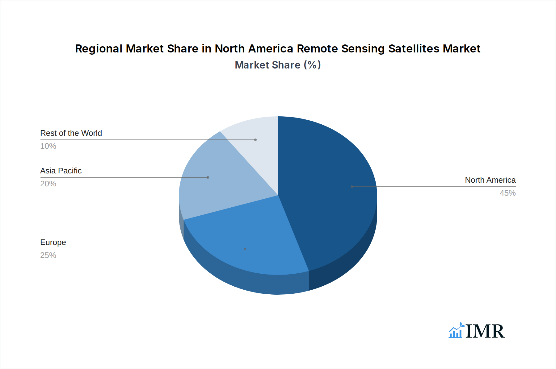
North America Remote Sensing Satellites Market Regional Market Share
Geographic Coverage of North America Remote Sensing Satellites Market
North America Remote Sensing Satellites Market REPORT HIGHLIGHTS
| Aspects | Details |
|---|---|
| Study Period | 2020-2034 |
| Base Year | 2025 |
| Estimated Year | 2026 |
| Forecast Period | 2026-2034 |
| Historical Period | 2020-2025 |
| Growth Rate | CAGR of 11.59% from 2020-2034 |
| Segmentation |
|
Table of Contents
- 1. Introduction
- 1.1. Research Scope
- 1.2. Market Segmentation
- 1.3. Research Objective
- 1.4. Definitions and Assumptions
- 2. Executive Summary
- 2.1. Market Snapshot
- 3. Market Dynamics
- 3.1. Market Drivers
- 3.2. Market Restrains
- 3.3. Market Trends
- 3.4. Market Opportunities
- 4. Market Factor Analysis
- 4.1. Porters Five Forces
- 4.1.1. Bargaining Power of Suppliers
- 4.1.2. Bargaining Power of Buyers
- 4.1.3. Threat of New Entrants
- 4.1.4. Threat of Substitutes
- 4.1.5. Competitive Rivalry
- 4.2. PESTEL analysis
- 4.3. BCG Analysis
- 4.3.1. Stars (High Growth, High Market Share)
- 4.3.2. Cash Cows (Low Growth, High Market Share)
- 4.3.3. Question Mark (High Growth, Low Market Share)
- 4.3.4. Dogs (Low Growth, Low Market Share)
- 4.4. Ansoff Matrix Analysis
- 4.5. Supply Chain Analysis
- 4.6. Regulatory Landscape
- 4.7. Current Market Potential and Opportunity Assessment (TAM–SAM–SOM Framework)
- 4.8. IMR Analyst Note
- 4.1. Porters Five Forces
- 5. Market Analysis, Insights and Forecast 2021-2033
- 5.1. Market Analysis, Insights and Forecast - by Satellite Mass
- 5.1.1. 10-100kg
- 5.1.2. 100-500kg
- 5.1.3. 500-1000kg
- 5.1.4. Below 10 Kg
- 5.1.5. above 1000kg
- 5.2. Market Analysis, Insights and Forecast - by Orbit Class
- 5.2.1. GEO
- 5.2.2. LEO
- 5.2.3. MEO
- 5.3. Market Analysis, Insights and Forecast - by Satellite Subsystem
- 5.3.1. Propulsion Hardware and Propellant
- 5.3.2. Satellite Bus & Subsystems
- 5.3.3. Solar Array & Power Hardware
- 5.3.4. Structures, Harness & Mechanisms
- 5.4. Market Analysis, Insights and Forecast - by End User
- 5.4.1. Commercial
- 5.4.2. Military & Government
- 5.4.3. Other
- 5.5. Market Analysis, Insights and Forecast - by Region
- 5.5.1. North America
- 5.1. Market Analysis, Insights and Forecast - by Satellite Mass
- 6. North America Remote Sensing Satellites Market Analysis, Insights and Forecast, 2021-2033
- 6.1. Market Analysis, Insights and Forecast - by Satellite Mass
- 6.1.1. 10-100kg
- 6.1.2. 100-500kg
- 6.1.3. 500-1000kg
- 6.1.4. Below 10 Kg
- 6.1.5. above 1000kg
- 6.2. Market Analysis, Insights and Forecast - by Orbit Class
- 6.2.1. GEO
- 6.2.2. LEO
- 6.2.3. MEO
- 6.3. Market Analysis, Insights and Forecast - by Satellite Subsystem
- 6.3.1. Propulsion Hardware and Propellant
- 6.3.2. Satellite Bus & Subsystems
- 6.3.3. Solar Array & Power Hardware
- 6.3.4. Structures, Harness & Mechanisms
- 6.4. Market Analysis, Insights and Forecast - by End User
- 6.4.1. Commercial
- 6.4.2. Military & Government
- 6.4.3. Other
- 6.1. Market Analysis, Insights and Forecast - by Satellite Mass
- 7. Competitive Analysis
- 7.1. Company Profiles
- 7.1.1 ImageSat International
- 7.1.1.1. Company Overview
- 7.1.1.2. Products
- 7.1.1.3. Company Financials
- 7.1.1.4. SWOT Analysis
- 7.1.2 GomSpaceApS
- 7.1.2.1. Company Overview
- 7.1.2.2. Products
- 7.1.2.3. Company Financials
- 7.1.2.4. SWOT Analysis
- 7.1.3 LeoStella
- 7.1.3.1. Company Overview
- 7.1.3.2. Products
- 7.1.3.3. Company Financials
- 7.1.3.4. SWOT Analysis
- 7.1.4 Esri
- 7.1.4.1. Company Overview
- 7.1.4.2. Products
- 7.1.4.3. Company Financials
- 7.1.4.4. SWOT Analysis
- 7.1.5 Lockheed Martin Corporation
- 7.1.5.1. Company Overview
- 7.1.5.2. Products
- 7.1.5.3. Company Financials
- 7.1.5.4. SWOT Analysis
- 7.1.6 Ball Corporation
- 7.1.6.1. Company Overview
- 7.1.6.2. Products
- 7.1.6.3. Company Financials
- 7.1.6.4. SWOT Analysis
- 7.1.7 Maxar Technologies Inc
- 7.1.7.1. Company Overview
- 7.1.7.2. Products
- 7.1.7.3. Company Financials
- 7.1.7.4. SWOT Analysis
- 7.1.8 IHI Corp
- 7.1.8.1. Company Overview
- 7.1.8.2. Products
- 7.1.8.3. Company Financials
- 7.1.8.4. SWOT Analysis
- 7.1.9 Thale
- 7.1.9.1. Company Overview
- 7.1.9.2. Products
- 7.1.9.3. Company Financials
- 7.1.9.4. SWOT Analysis
- 7.1.10 Planet Labs Inc
- 7.1.10.1. Company Overview
- 7.1.10.2. Products
- 7.1.10.3. Company Financials
- 7.1.10.4. SWOT Analysis
- 7.1.11 Northrop Grumman Corporation
- 7.1.11.1. Company Overview
- 7.1.11.2. Products
- 7.1.11.3. Company Financials
- 7.1.11.4. SWOT Analysis
- 7.1.12 Spire Global Inc
- 7.1.12.1. Company Overview
- 7.1.12.2. Products
- 7.1.12.3. Company Financials
- 7.1.12.4. SWOT Analysis
- 7.1.13 Capella Space Corp
- 7.1.13.1. Company Overview
- 7.1.13.2. Products
- 7.1.13.3. Company Financials
- 7.1.13.4. SWOT Analysis
- 7.1.1 ImageSat International
- 7.2. Market Entropy
- 7.2.1 Company's Key Areas Served
- 7.2.2 Recent Developments
- 7.3. Company Market Share Analysis 2025
- 7.3.1 Top 5 Companies Market Share Analysis
- 7.3.2 Top 3 Companies Market Share Analysis
- 7.4. List of Potential Customers
- 8. Research Methodology
List of Figures
- Figure 1: North America Remote Sensing Satellites Market Revenue Breakdown (billion, %) by Product 2025 & 2033
- Figure 2: North America Remote Sensing Satellites Market Share (%) by Company 2025
List of Tables
- Table 1: North America Remote Sensing Satellites Market Revenue billion Forecast, by Satellite Mass 2020 & 2033
- Table 2: North America Remote Sensing Satellites Market Revenue billion Forecast, by Orbit Class 2020 & 2033
- Table 3: North America Remote Sensing Satellites Market Revenue billion Forecast, by Satellite Subsystem 2020 & 2033
- Table 4: North America Remote Sensing Satellites Market Revenue billion Forecast, by End User 2020 & 2033
- Table 5: North America Remote Sensing Satellites Market Revenue billion Forecast, by Region 2020 & 2033
- Table 6: North America Remote Sensing Satellites Market Revenue billion Forecast, by Satellite Mass 2020 & 2033
- Table 7: North America Remote Sensing Satellites Market Revenue billion Forecast, by Orbit Class 2020 & 2033
- Table 8: North America Remote Sensing Satellites Market Revenue billion Forecast, by Satellite Subsystem 2020 & 2033
- Table 9: North America Remote Sensing Satellites Market Revenue billion Forecast, by End User 2020 & 2033
- Table 10: North America Remote Sensing Satellites Market Revenue billion Forecast, by Country 2020 & 2033
- Table 11: United States North America Remote Sensing Satellites Market Revenue (billion) Forecast, by Application 2020 & 2033
- Table 12: Canada North America Remote Sensing Satellites Market Revenue (billion) Forecast, by Application 2020 & 2033
- Table 13: Mexico North America Remote Sensing Satellites Market Revenue (billion) Forecast, by Application 2020 & 2033
Frequently Asked Questions
1. What is the projected Compound Annual Growth Rate (CAGR) of the North America Remote Sensing Satellites Market?
The projected CAGR is approximately 11.59%.
2. Which companies are prominent players in the North America Remote Sensing Satellites Market?
Key companies in the market include ImageSat International, GomSpaceApS, LeoStella, Esri, Lockheed Martin Corporation, Ball Corporation, Maxar Technologies Inc, IHI Corp, Thale, Planet Labs Inc, Northrop Grumman Corporation, Spire Global Inc, Capella Space Corp.
3. What are the main segments of the North America Remote Sensing Satellites Market?
The market segments include Satellite Mass, Orbit Class, Satellite Subsystem, End User.
4. Can you provide details about the market size?
The market size is estimated to be USD 25.37 billion as of 2022.
5. What are some drivers contributing to market growth?
N/A
6. What are the notable trends driving market growth?
OTHER KEY INDUSTRY TRENDS COVERED IN THE REPORT.
7. Are there any restraints impacting market growth?
N/A
8. Can you provide examples of recent developments in the market?
April 2023: NASA has awarded a sole source Blanket Purchase Agreement (BPA) to Capella Space Corporation of San Francisco to provide high-resolution Synthetic Aperture Radar (SAR) (0.5 meter to 1.2 meters) commercial Earth observation data products.March 2023: Rocket Lab's Electron rocket launched CapellaSpace's pair of commercial radar imaging satellites into orbit that are capable of seeing through clouds, in daylight or darkness, to monitor the planet below.February 2023: NASA and geographic information service provider Esri will grant wider access to the space agency's geospatial content for research and exploration purposes through the Space Act Agreement.
9. What pricing options are available for accessing the report?
Pricing options include single-user, multi-user, and enterprise licenses priced at USD 3800, USD 4500, and USD 5800 respectively.
10. Is the market size provided in terms of value or volume?
The market size is provided in terms of value, measured in billion.
11. Are there any specific market keywords associated with the report?
Yes, the market keyword associated with the report is "North America Remote Sensing Satellites Market," which aids in identifying and referencing the specific market segment covered.
12. How do I determine which pricing option suits my needs best?
The pricing options vary based on user requirements and access needs. Individual users may opt for single-user licenses, while businesses requiring broader access may choose multi-user or enterprise licenses for cost-effective access to the report.
13. Are there any additional resources or data provided in the North America Remote Sensing Satellites Market report?
While the report offers comprehensive insights, it's advisable to review the specific contents or supplementary materials provided to ascertain if additional resources or data are available.
14. How can I stay updated on further developments or reports in the North America Remote Sensing Satellites Market?
To stay informed about further developments, trends, and reports in the North America Remote Sensing Satellites Market, consider subscribing to industry newsletters, following relevant companies and organizations, or regularly checking reputable industry news sources and publications.
Methodology
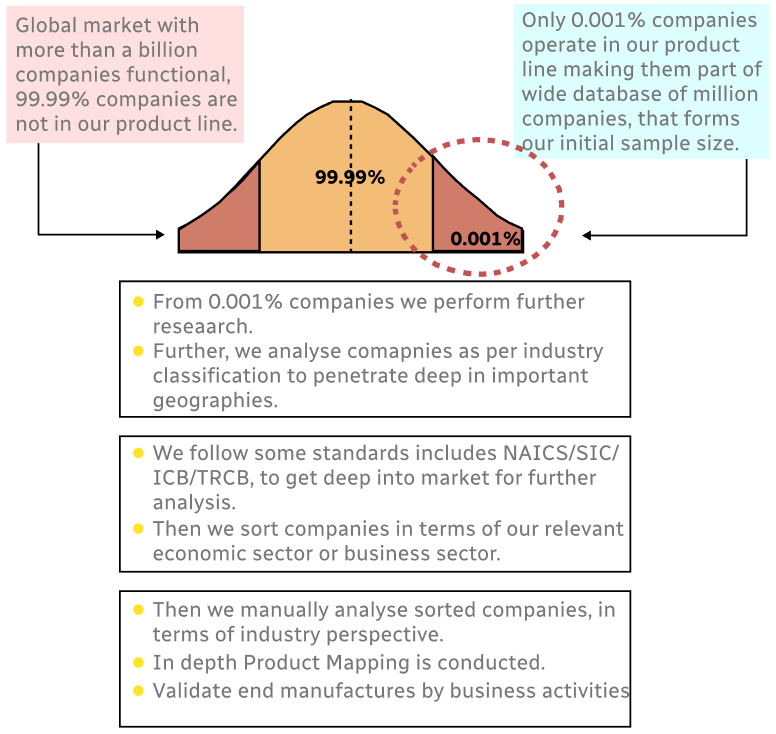
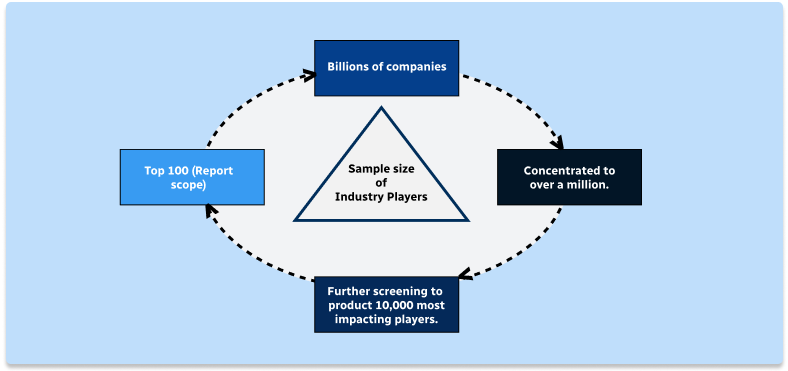
Step 1 - Identification of Relevant Samples Size from Population Database
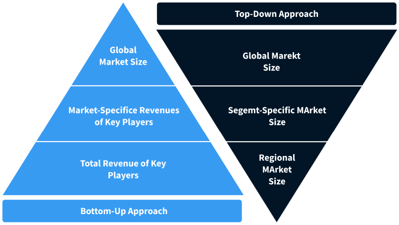
Step 2 - Approaches for Defining Global Market Size (Value, Volume* & Price*)
Note*: In applicable scenarios
Step 3 - Data Sources
Primary Research
- Web Analytics
- Survey Reports
- Research Institute
- Latest Research Reports
- Opinion Leaders
Secondary Research
- Annual Reports
- White Paper
- Latest Press Release
- Industry Association
- Paid Database
- Investor Presentations
Step 4 - Data Triangulation
Involves using different sources of information in order to increase the validity of a study
These sources are likely to be stakeholders in a program - participants, other researchers, program staff, other community members, and so on.
Then we put all data in single framework & apply various statistical tools to find out the dynamic on the market.
During the analysis stage, feedback from the stakeholder groups would be compared to determine areas of agreement as well as areas of divergence